Description:
I've always loved Sandon. I've taken the kids here on multiple occasions, and have a cache hidden on Plover Island. One day I was looking at SIX maps, and noticed a nearby trig. It looks a challenge, as it's on the other side of the water than the parking location, and there doesn't appear to be a track leading to the trig. These headlands are often very overgrown and hard to traverse. But I'm up for the challenge.
Resources:
UPDATED! GPX File: Location of the trig station, parking coordinates, water entry and exit points and the other cache I have hidden on Plover Island
Survey Sketch: Survey notes regarding this trig station.
Hike Recommendations:
Gear: Kayak for the water crossing
Parking: Parking available at Sandon River Campgrounds.
Season: Summer is good - nice opportunity for a swim afterwards.
Biggest Challenge: Finding somewhere to stash the kayak while I head off and find the trig.
Updates:
I decided to hide a GC cache here as part of the Dirtbags Group. It's a nice area and a good walk with a kayak thrown in. A nice place to get away from the world and appreciate the simple things. You can see the cache page here:
There's also my GCA cache sitting on Plover Island, still without a finder.
This map was created using GPS Visualizer's do-it-yourself geographic utilities.
Please wait while the map data loads...
Progress Notes:
25/Jul/2021: The weather was nice so I decided I’d make a trek to try and find another unlisted trig. I noticed that there was a trig close to Sandon Village. I’ve never actually been to the village as a 4WD is required, as a trip along the beach at low tide is the only way to get there. The ‘Sandon Back Track’ is now locked, and for use by residents of the village only.
I decided for the alternate entrance to the village today. I bought my kayak with me and parked at the Sandon River Campgrounds on the other side of the river. It didn’t take long to paddle across. The wind was making the water quite choppy though, and I did end up quite wet. You could swim it, but I’ve heard it’s a bit dangerous to swim across at certain tide times – and it would have been hard to keep the phone and GPS dry. Today I saw a massive turtle halfway across the river. It must have been a meter across, popping up and gulping some air before disappearing below the surface again. The water temperature was really nice, considering it’s winter.
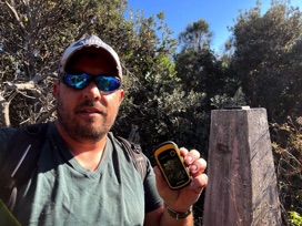
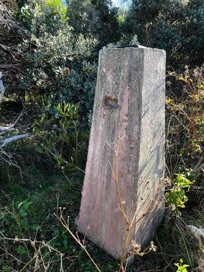
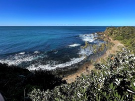
Once across, I stashed my kayak in some grass and wandered down a track. Maps didn’t show any trail to the trig, so I bush bashed my way in. A few scratches later I arrive at the top of a sea cliff, which was where the trig was located.
The trig is without mast and vanes, but they were located very close by, buried in thick grass. The vanes are quite rusted. The name plate is also missing. I imagine when the area was cleared the views would have been spectacular, but I only had to move 5 meters or so to a clearing and I could see the rocky beach below. Bit of a dangerous area, as it would be a long drop if one lost one’s footing.
As I made my way back to the village, I could smell someone cooking bacon and eggs for breakfast. Such a simple, peaceful life these villagers have. I’m jealous.
A great adventure and I loved every minute of this one.
RECOMMENDED!
Current Status:
SUCCESS
Photos:
If you've done this trek, or would like to comment on it, please do so below.
You may attach a photo to your comment if you'd like too.


