Description:
I've seen this trig on the map and have been curious about it's access. There are a few trigs out here, west of Casino - and there's quite a few located not to far from reasonable roads, but you never know if they're on private property or not. This one looks safe, so I need to check it out.
Resources:
UPDATED! GPX File: Location of the trig station and the parking coordinates.
Survey Sketch: Survey notes regarding this trig station.
Hike Recommendations:
Gear: nothing special needed
Parking: Parking beside Clarence Way. Ample Room.
Season: Any season, could be snakes about in warmer weather though.
Biggest Challenge: Long Grass
Updates:
I decided to hide a GC cache here. It's a nice area and a good walk. A nice place to get away from the world and appreciate the simple things. You can see the cache page here:
This map was created using GPS Visualizer's do-it-yourself geographic utilities.
Please wait while the map data loads...
Progress Notes:
20/Mar/2023: I had a day off work so decided to check out a couple of potential trigs while testing out a new app that used SIX maps as their overlay. This was number two for the day. I’d scoped this trig out previously, and found a few places that could offer access to it. One from the north, down an electrical easement, another from the south and the one I chose on the west. Maps showed a track of some kind, but I couldn’t see anything on satellite imagery.
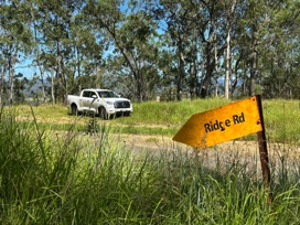
I parked at S29° 4.361' E152° 36.192' and made my way up what was signposted as Ridge Road. Little more than some sandstone rock that had been exposed by heavy rain. There were overgrown patches as I climbed a bit higher in elevation, and I was soon at a gate. The walking was much clearer after this - I followed an old road, now cattle trail for a while - some nice easy walking, and then started to climb a hill. There were a few good views between the trees as I climbed. Near the top I could see Mt Superbus - the highest mountain in Southern Queensland and far south as the Timbarra Trig Hill. I wouldn’t have know I could see so much from up here.
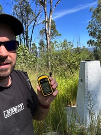
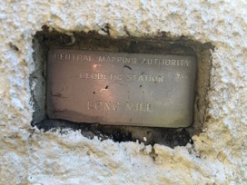
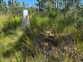
The top of the hill is home to the trig. A concrete pillar in good condition, sans pole and vanes. The old cairn from what would have been the previous trig is mostly dismantled but still recognisable. The name plate reading “Long Mile” is still present.
A nice pleasant walk without having to get too hot or sweaty.
RECOMMENDED!
Current Status:
SUCCESS
Photos:
If you've done this trek, or would like to comment on it, please do so below.
You may attach a photo to your comment if you'd like too.


