Description:
I always enjoy my time in Ewingar Forest, and have been checking off as many trigs and interesting things as I can find in the area. The places is as full of history as anywhere in this part of the state. After finding the trigs in the northern parts of this forest, it is time to push south and get some that may be more difficult,
Resources:
UPDATED! GPX File: Location of the trig station, the place to leave your vehicle and the spot where we left the comfort of the walking track and bush bashed through the scrub to find our trig.
Survey Sketch: Survey notes regarding this trig station.
Hike Recommendations:
Gear: A machete could be handy!
Parking: Park at junction of North Ewingar, Billilimbra and Lionsville Roads.
Season: Any season, could be snakes about in warmer weather though.
Biggest Challenge: The bush bash from the trail to the trig.
This map was created using
GPS Visualizer
's do-it-yourself geographic utilities.
Please wait while the map data loads...
Progress Notes:
12/Mar/2023: Decided that it would be nice to get outside again with my good adventuring mate. A plan was that we’d find something fun to do this weekend - rain, hail or shine. We got rain.
We left Lismore and on our way west the sky cleared up a bit, but once at Tabulam the dark clouds came back and the rain started. As we entered the forest there were patches of fog, quite heavy at times, but it only made the wet, glossy green vegetation even brighter and more inviting.
We were unsure of how far we could drive to this cache, but decided to leave the rig parked where North Ewingar Road ends and Lionsville Road begins. Even though everything was wet, the road wasn’t slippery.
From here we walked the trail - up and down a few easy slopes - getting closer and closer to GZ. We probably could have driven a bit further up this road, though some small trees have fallen and would need to be removed for my ute to pass them. The walk in the rain was refreshing though. A perfect temperature for walking. Not too warm, and not too cool to be uncomfortable in wet clothes. The company, conversation and setting were all perfect for a wet Sunday, and I can’t think of any conditions that could have been better for the pursuit of this trig.
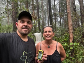
We closed in on GZ. It looked a pretty steep climb from the trail up to the hill top where the trig is said to have been, so we walked on a bit further to see if there was an easier way. Eventually, a large log over the road, and an increased distance to GZ had us turn around. The GPS read about 125m from GZ when we found what we thought would be the best way up, and from there we pushed through the thick wattle and the vines of steel, climbing up bit by bit until we saw a familiar site.
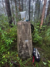
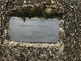
The trig was like a few others out this way. The 2019 fires had caused the PVC mast to become quite flaccid, and even a quick lick would not rectify it. I imagine the journey to this trig after the fires would have been a lot easier than today, but bush bashing was just part of the fun. Photos were taken and then we left the trig, whose name plate is still attached and other that not being as erect as it once was - is still in good condition. I don’t think this one will get many visitors, other than the odd laughing cockatoo flying overhead.
Once back at the car we peeled all the leaches off us and drove back to Casino for a hot lunch. What a great day out. Come find this trig, if you dare.
RECOMMENDED!
Current Status:
SUCCESS
Photos:
If you've done this trek, or would like to comment on it, please do so below.
You may attach a photo to your comment if you'd like too.


