Description:
This trig is accessed from the New England Highway. In the words of a previous finder:
"Parked on the highway and Mr T made the 3k return trek to this trig. Picking his way through large granite boulders and steep sections he made his way tho the top. Good views of the surrounding area".
I think this one will be particularly fun. There are clues in the Survey Sketch below on best access, but 9finding the way to this one will be a large part of the enjoyment.
Resources:
GPX File: Location of the trig station. GPX formatted as a geocache.
Survey Sketch: Survey notes regarding this trig station.
Hike Recommendations:
Gear: nothing special needed
Parking: Parking beside New England Highway.
Season: Any season, could be snakes about in warmer weather though.
Biggest Challenge: Some rock hopping by the looks of things.
This map was created using GPS Visualizer's do-it-yourself geographic utilities.
Please wait while the map data loads...
Progress Notes:
21/Apr/2023: Decided to see if I could get my way to the top of this hill today. I've been out here a few times over the last few years at the temporary office that was built for the construction of the new road and bridge, but never enough time to try and climb the rocks. I've wanted to do this for a while now. So with the colder weather edging in, it made this walk even more inviting today.
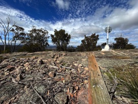
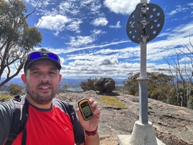
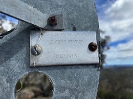
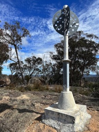
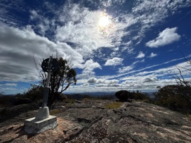
There's no trail to the top, though I picked my way though the granite without too much difficulty. There were a lot of kangaroos all over the place, and the tracks left by them often was the easiest way up. I had a topo map in which I was trying to follow a path where the contours were spaced further apart, and this strategy seemed to work. After an hour I was up top and there was the trig in all its glory. The trig is in good condition, with the nameplate still attached firmly to one of the vanes. The original pole from the old trig is nearby, and the broad arrow can still be seen carved into the wood. Some magnificent views up here towards Bolivia and Tenterfield, and out towards the East. I stayed up here for a while to appreciate it, then made my way back down. I chose a completely different route back down, which was longer - but not too steep, and was very quiet and enjoyable.
I was going to go for a drive to another nearby trig, but decided to grab a few caches on the highway and make my way back home instead as the cloud were starting to darken and I had a few hours drive ahead of me.
Current Status:
SUCCESS
Photos:
If you've done this trek, or would like to comment on it, please do so below.
You may attach a photo to your comment if you'd like too.

